
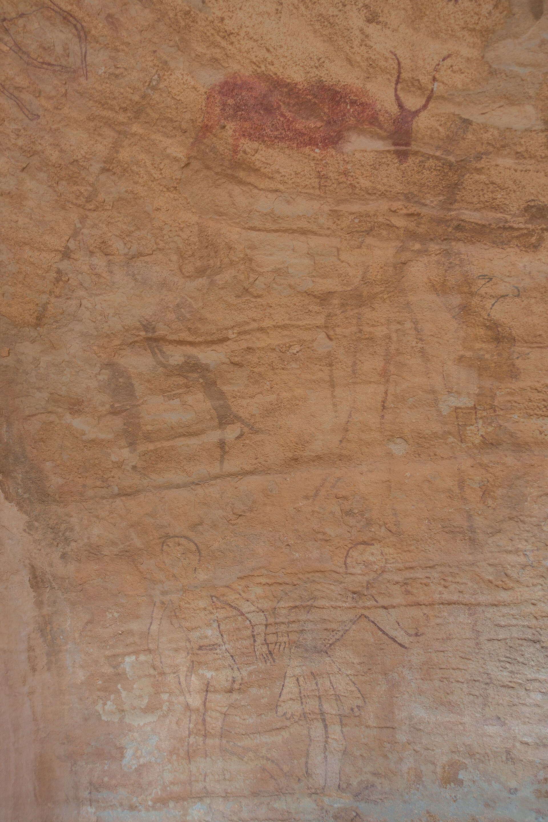
In the late 1950s, the French ethnologist Henri Lhote embarked on a journey to Tassili n'Ajjer, a sandstone plateau located in southeastern Algeria. For generations, local Tuareg guides had been showing visitors the remarkable rock paintings found there, but it was Lhote who meticulously photographed and catalogued thousands of these images. The paintings depicted scenes that defied the current reality of the central Sahara, a region so arid it receives less than 20 millimetres of rainfall annually. The artworks showed long-horned cattle being herded, hippopotamuses wallowing in rivers, and giraffes and elephants traversing a verdant landscape. Humans were depicted in flowing robes, engaged in dance or hunting, and among them were figures Lhote fancifully named 'martians'—likely masked dancers. Some paintings were clearly several thousand years old, with the oldest possibly dating back to 8000 BCE. This rich tableau hinted at a past ecosystem that no longer existed at Tassili, suggesting that the Sahara was once a thriving savanna, not the inhospitable desert we know today.

When and how
The transformation of the Sahara from a verdant landscape to a barren desert occurred during the African Humid Period, which spanned roughly from 11,500 to 5,000 years ago. At the height of this period, around 6000 BCE, the Sahara received significantly more rainfall than it does today—between 300 and 1000 millimetres annually, compared to the current 0 to 150 millimetres. This shift in climate was driven by a process known as orbital forcing. Specifically, the precession of the Earth's axis, which follows a 23,000-year cycle, altered the seasonal distribution of solar radiation. During the early Holocene, the Northern Hemisphere's summer coincided with perihelion, the point at which Earth is closest to the Sun. This intensified the West African Monsoon, moving the rainfall belts approximately 600 kilometres northward, encompassing what is now the Sahara.
This shift was a natural, predictable consequence of the Earth's axial tilt and orbital configuration—mechanisms well established in paleoclimate models. The Sahara was wetter because of this specific orbital phase, which enabled the monsoon rains to extend into the region. However, as the Earth's axial precession continued, the monsoon belts gradually retreated southward, leading to the arid conditions we associate with the Sahara today. The desert, therefore, is not the timeless state of the Sahara, but a recent development in its climatic history.
What was there
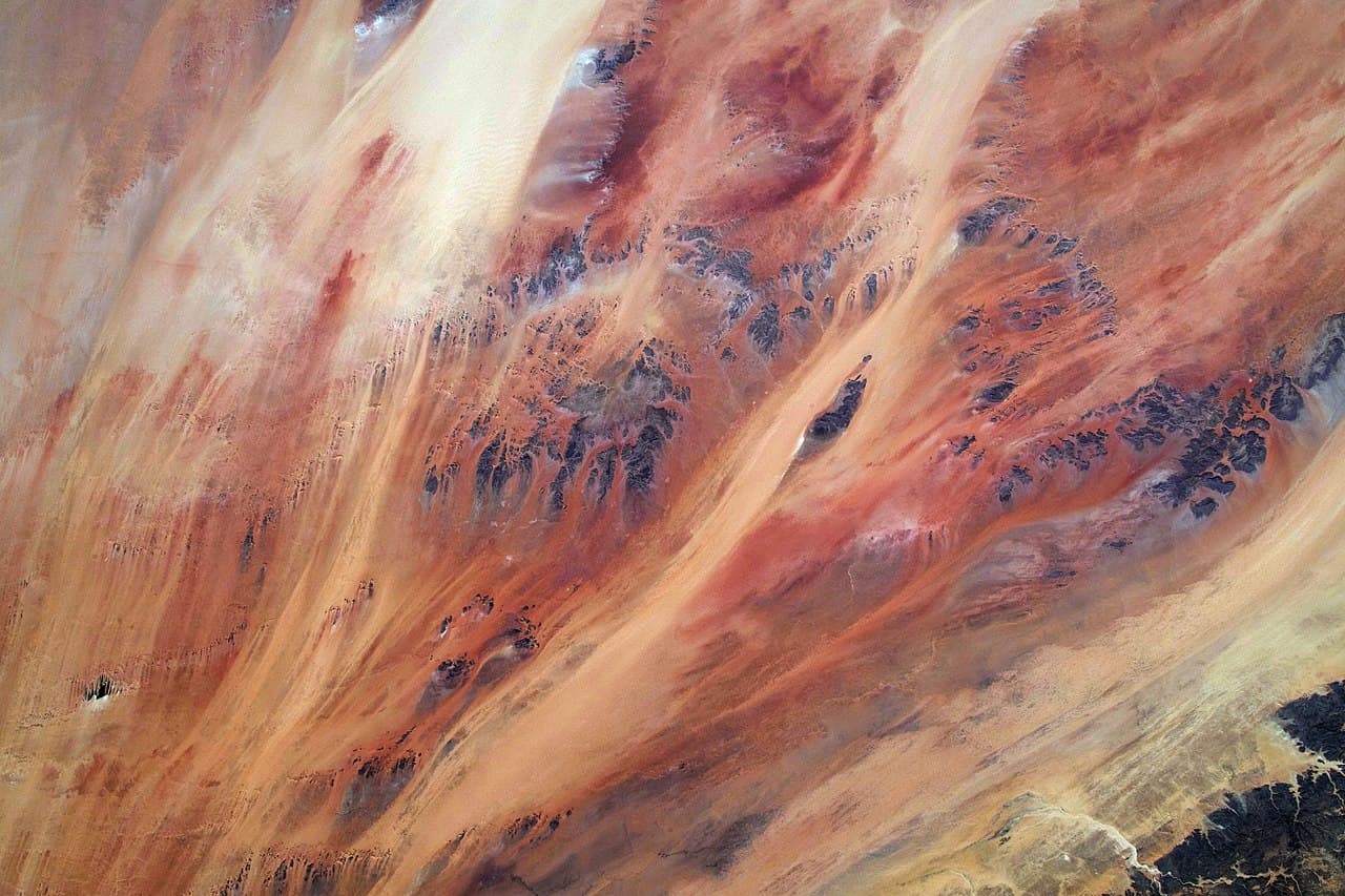
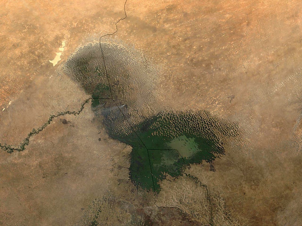
The Green Sahara was home to a multitude of significant water bodies and vibrant ecosystems. Among these was Lake Mega-Chad, a colossal freshwater lake that once covered an area of 350,000 square kilometres, surpassing the size of the modern Caspian Sea. It spanned what is now Chad and Niger, fed by river systems such as the Tafassasset and Tilemsi, which drained southward from the Hoggar mountains. Additionally, Lake Mega-Fezzan in southwest Libya and numerous smaller lakes and rivers flourished across regions now blanketed by the Ténéré, Tanezrouft, and Murzuq sand seas.
Fauna thrived in this lush environment, including species now associated with more humid regions. Nile crocodiles, whose isolated populations persisted in Saharan oases until the mid-20th century, were common sights. Hippopotamuses, with bones still unearthed in dry lake beds in Mauritania and Mali, roamed alongside elephants, giraffes, lions, and antelopes. The Sahara's savanna was akin to the modern East African plains, a mosaic of grasslands interspersed with acacia, palm, and terebinth trees—evidence captured in pollen records extracted from sediment cores.
The people
Human habitation in the Green Sahara is recorded vividly in its rock art, spanning from 12,000 BCE to around 1000 BCE. This tradition is categorised into four broad periods. The earliest, known as the 'Bubaline' period, dates from roughly 12,000 to 8000 BCE and predominantly features wild fauna such as large fish, hippopotamuses, and wild buffalo, indicative of hunter-gatherer societies. This was succeeded by the 'Round-Head' period (8000-6000 BCE), characterised by large, stylised human figures, likely correlating with the early peak of the humid period.
The most iconic, however, is the 'Pastoral' period (6000-2000 BCE), which prominently features cattle—a sign that the populations had transitioned to herding. Genetic studies, such as those by the David Reich lab, published in 2022, have demonstrated that these pastoralists were genetically linked to ancestral Berber groups, with subsequent admixture from sub-Saharan and West Asian peoples. The decline of this pastoral lifestyle coincided with deteriorating conditions; by 2000 BCE, depictions shifted to dromedary camels, marking the advent of the camel-and-caravan culture known from later historical periods.
How fast it ended
The African Humid Period ended with surprising rapidity, especially in geological terms. Various paleoclimate proxies, including lake-sediment cores and marine sediment records, indicate a weakening of the monsoon system starting around 5500 BCE. By 3000 BCE, the central Sahara had transformed into the hyperarid desert we recognise today. This swift transition is attributed to a complex interplay between gradual orbital changes and abrupt vegetation-albedo feedback mechanisms. As the vegetation began to die back, the increased surface reflectivity (albedo) reduced local evaporation, which in turn caused further retreat of the monsoon rains.
This feedback loop led to the Sahara flipping from a wet savanna to a dry desert in a relatively short time between 5000 and 4000 BCE. Once this threshold was crossed, the system stabilised in its current arid state. The timing of this climatic shift broadly coincided with the rise of the early dynastic state in Egypt along the Nile—an area that may have served as a refuge for populations displaced by the Sahara's inhospitable new conditions.
How we know
Our understanding of the Green Sahara is built on a robust foundation of multidisciplinary evidence. Sediment cores extracted from beneath today's dry lake beds reveal fossilised layers rich in pollen and microorganisms indicative of past freshwater environments. Advanced satellite radar imaging technology has unearthed extensive buried river systems, such as the Tamanrasset Paleoriver in Mauritania, which was once among Africa's largest rivers, rivaling the length of the modern Rhine.
Moreover, sediment layers from the Atlantic seabed off the coast of northwest Africa contain windblown Saharan dust deposits. These deposits exhibit a marked increase in dust flux around 5500 BCE, aligning with the establishment of the desert landscape. The archaeological record complements these findings, with rock art, faunal remains, and lithic industries painting a coherent picture of a once thriving, now vanished ecosystem. The documentation of the Saharan greening stands as one of the most thoroughly chronicled climate transitions in prehistoric times.
What it tells us
The story of the Green Sahara, though compelling, is not easily applied as an allegory for contemporary climate change. Its primary driver was the slow, celestial ballet of Earth's orbital mechanics—a force beyond human intervention. While rapid desertification may have been hastened by feedback loops, the overarching cause was astronomical. Unlike the Green Sahara, current climate shifts are marked by anthropogenic influences that diverge from these natural cycles. The Sahara's history serves as a poignant reminder that the climatic conditions we consider normal are but fleeting states in the grand tapestry of Earth's history.
The Sahara, like many other climate-defined regions, has experienced multiple states within the span of human existence. The Mediterranean's dry summers, the Amazon's lush rainforests, and the frigid winters of central Asia are all transient conditions. These shifts, often occurring within timescales accessible to human documentation, challenge our perception of climatic stability. The Sahara's dramatic transformation is a powerful example of this inherent variability, highlighting that what we regard as the status quo is but a recent chapter in a much longer narrative.
Today, remnants of the Green Sahara persist, albeit subtly. The rock paintings of Tassili have endured the passage of time, their significance recognised by UNESCO's designation of the site in 1982. While tourist access is limited to preserve the integrity of these ancient artworks, major rock-art sites like Akakus in Libya and Tibesti in Chad continue to offer glimpses into this forgotten past. Satellite imagery reveals the ghostly traces of buried rivers, while the bones of Mega-Chad's once abundant hippos lie interred in Mauritanian sediments. Although the Tuareg guides at Tassili refer to the 'people of the time when the river was here,' the living memory of the wet Sahara has faded. Yet, the land itself retains its story—in its sediments, its rock art, and the hidden waters beneath its surface. The desert is the recent fact; the lush, vibrant Sahara is the older, enduring truth.
References
- deMenocal, P. B., et al. (2000). Abrupt onset and termination of the African Humid Period: rapid climate responses to gradual insolation forcing. Quaternary Science Reviews, 19(1-5), 347–361.
- van der Lubbe, H. J. L., et al. (2014). Paleo-precipitation record from a humid Sahara: insights from the deep-sea sedimentary archive. Nature Geoscience, 7(11), 808–812.
- Salvatore, S. M., et al. (2022). Genome of a Middle Holocene Saharan forager. Nature, 609, 1019–1026.
- Lhote, H. (1959). The Search for the Tassili Frescoes. E. P. Dutton.


